Space Photography
Using astronaut photographs of Earth in the classroom
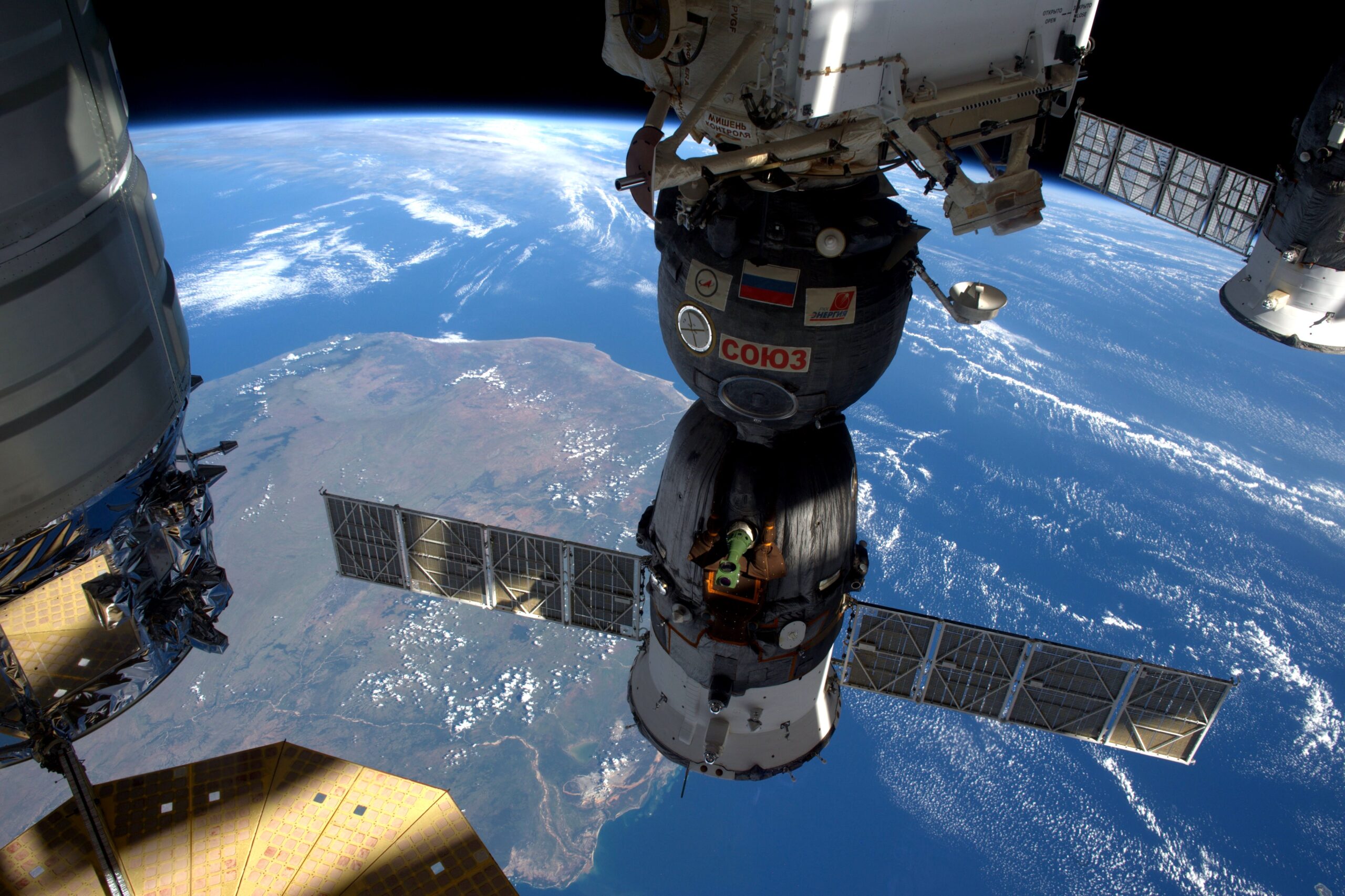
Tim Peake’s Hello, is this Planet Earth? sold nearly a quarter of a million copies within six weeks of coming out. Evidence, as if more were needed, of how fascinated we are by the view of our home from space.
The British ESA astronaut followed other International Space Station (ISS) crew members from Chris Hadfield to Scott Kelly in sharing his pictures and thoughts on social media and, like them, gained a wide following.
Whilst these photos are undoubtedly awe-inspiring, they are also useful in the classroom. Our EO Detective resources, produced for the Principia mission education programme, use astronaut photography and satellite imagery to cover concepts from maths, science, geography and computing. Suggestions for extension work provide links to English, citizenship, history and, of course, art.
Other ideas
Over 100 000 astronaut photographs of Earth spanning more than 60 years are free to download and reproduce. You might use them, for example:
- To update a resource that you love but where the images are out of date.
- To illustrate features of physical or human geography.
- To investigate how places have changed over time.
- To explore land use or habitats in a particular region or country – or to compare them.
- To see how the time of day changes the shadows cast by mountains or clouds.
- To intrigue, prompt or inspire your students.
Before you start searching, it is worth knowing that crewed spacecraft don’t fly over the poles and this limits the areas astronauts can photograph. For example, the orbit of the ISS does not take it beyond 52 degrees north or south. This means there are no ‘straight down’ (nadir view) pictures of places outside this band, and very few of the Arctic or Antarctica. However, if you’re interested in images of these regions, all is not lost: have a look at our page about <link to Education page 2.3> finding satellite images </link> to use in the classroom.
Where to start?
Social media is a great place to start looking for spectacular and very recent photographs, so checking out X, Instagram, Facebook, or flickr might be useful.
Many astronauts have accounts on at least one of these platforms. They often post topical pictures, photos of their home country or state, or images related to a particular interest such as Scott Kelley’s #EarthArt, Kjell Lindgren’s #StoryOfWater, or Thomas Pesquet’s #airports and #FridayIsland.
Pictures of specific places
If you are looking for photos of particular places, then maps curated by Dave MacLean from the Centre for Geographic Sciences in Nova Scotia are easy to use. They each show about a year’s worth of astronaut tweets and other pictures of Earth from space. When you click on a pin you can see the tweet. In some maps, you can click directly through to a higher resolution version of the image that you can download. If it is an older map, then you can probably track down the image on the NASA gateway (see below).
Going deeper
The Gateway to Astronaut Photography of Earth stores all the images taken with NASA cameras on the ISS and back through Space Shuttle missions to the Apollo, Gemini and Mercury programmes. You can delve into the archive using an interactive map (click ‘Explore Photos’) or search the full catalogue using a range of tools on the ‘Search Photos’ page that allow you to narrow down the image you want using a whole host of criteria. The page is reasonably easy to use but, if there are some things on it that don’t make sense to you, the FAQ page is comprehensive.


Search datasets and tools
NCEO produces various datasets related to climate change, including measurements of greenhouse gases, atmospheric composition, land surface changes and ocean health. These datasets are valuable for understanding the dynamics of climate change on a global scale and informing policies and actions to address it.