Wildfires Research Laboratories and Instrumentation
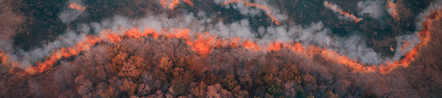
To understand the impacts of wildfires on the environment, it is vital to be able to characterise real world fires to enable a sense of typical characteristics from different types of fire.
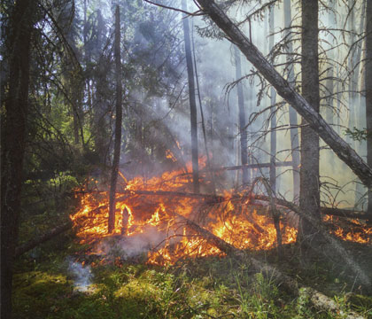
The impacts of fires will vary depending on the fire behaviour and fuel characteristics. For example, the emissions between a smouldering peat fire and flaming forest fire are very different and present different hazards.
Making measurements of real world and laboratory based fires is an important component of a wider understanding of fire emissions. Without this there is no knowledge of the variability of emissions that can be used when estimating larger scale impacts through modelling.
On this page learn more about:
Or visit our NCEO Airborne Earth Observatory Laboratory page, which enable a wide range of fire-related experiments using our range of instrumentation.
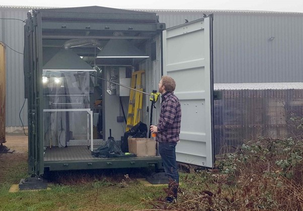
Ground-based instrumentation
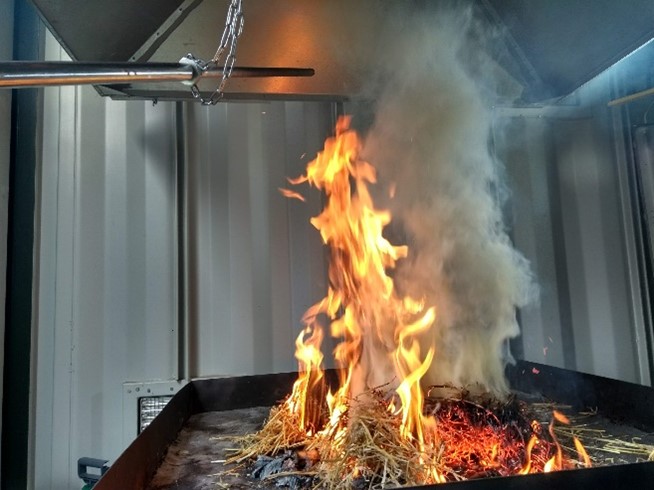
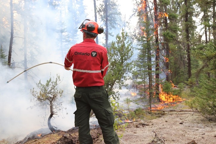
The NCEO-King’s team operate a wide range of ground-based instrumentation for making direct and remote sensing based measurements of fire emissions and their associated behaviour. Whilst field measurements represent real conditions, there are many practical limitations on collecting representative data.
Laboratory experiments enable more precision over controlling variables and repeated measurements and when used alongside field measurements provide a valuable dataset. A key quality of the team is the ability to use many of the same instruments in laboratory and field settings to improve confidence that laboratory experiments are representative of real world fires.
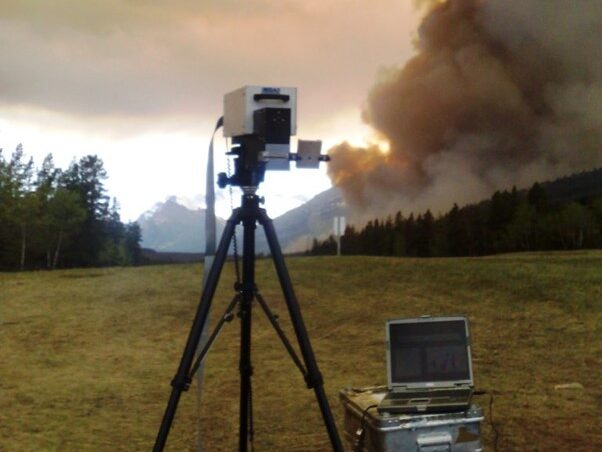
Thermal Cameras
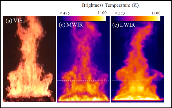
We use a range of thermal cameras that work at different wavelengths to enable us to quantify the thermal output of a fire, or smoke plume. These cameras can be set up to monitor a small area of a real-world fire, or entire laboratory fires and measure the thermal change over time. By linking these thermal measurements with other emissions measurements (of gases and particulates), it is possible to upscale emissions estimates from satellite derived thermal datasets [link to FRP page].
By utilising different cameras working on different wavelengths of the infrared spectrum, it is possible to focus on particular aspects of the fire, such as the ability to see the fuel through the smoke. Certain cameras also have the ability to include filters enabling a camera to exactly replicate a sensor on a satellite [link to Canada campaign page], or even to be able to see hot gases such as CO2 being emitted from a fire.
As well as being used on the ground, or in laboratory experiments, our thermal cameras are able to be mounted to survey aircraft, whilst some of the smaller cameras can also be flown on a UAV.
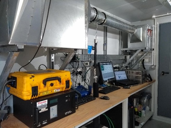
Infrared Gas Analysers
Detecting gasses emitted from fires is a key factor in calculating overall fire emissions. Some of these gases are emitted in relatively high concentrations (such as CO2, and CO) whilst many others are present in trace levels. The exact ratio of these gases to one another varies depending on the fire behaviour and fuel.
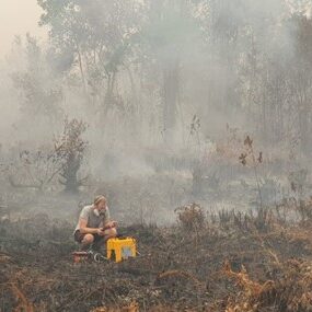
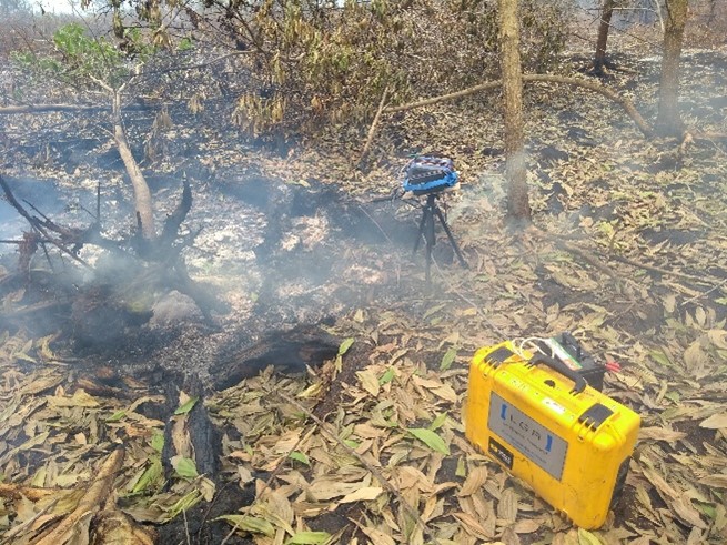
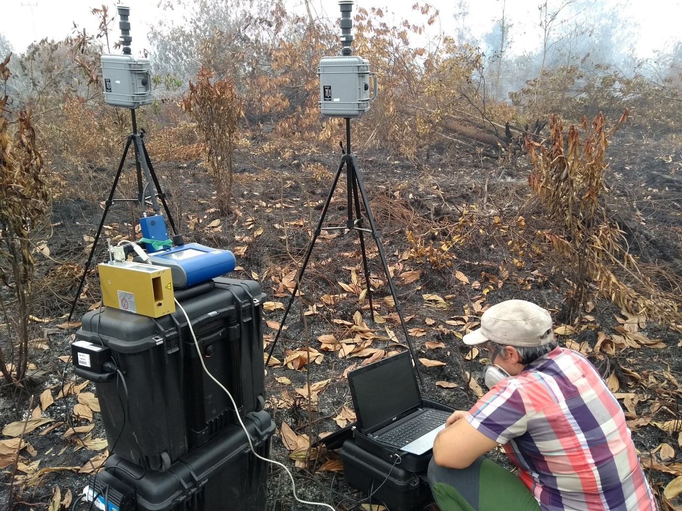
Our gas analysers include laboratory grade detection, and field portable sensors of varying sizes. Field analysers are robustly built to enable measurements of smoke plumes slightly downwind of the fire. Smaller hand held gas analysers often offer slightly lower precision, but increase the range of locations where measurements can be practicably made. For instruments that are not practical to take to the active fire front, samples can be collected in gas bags and brought back to the instrument for analysis.
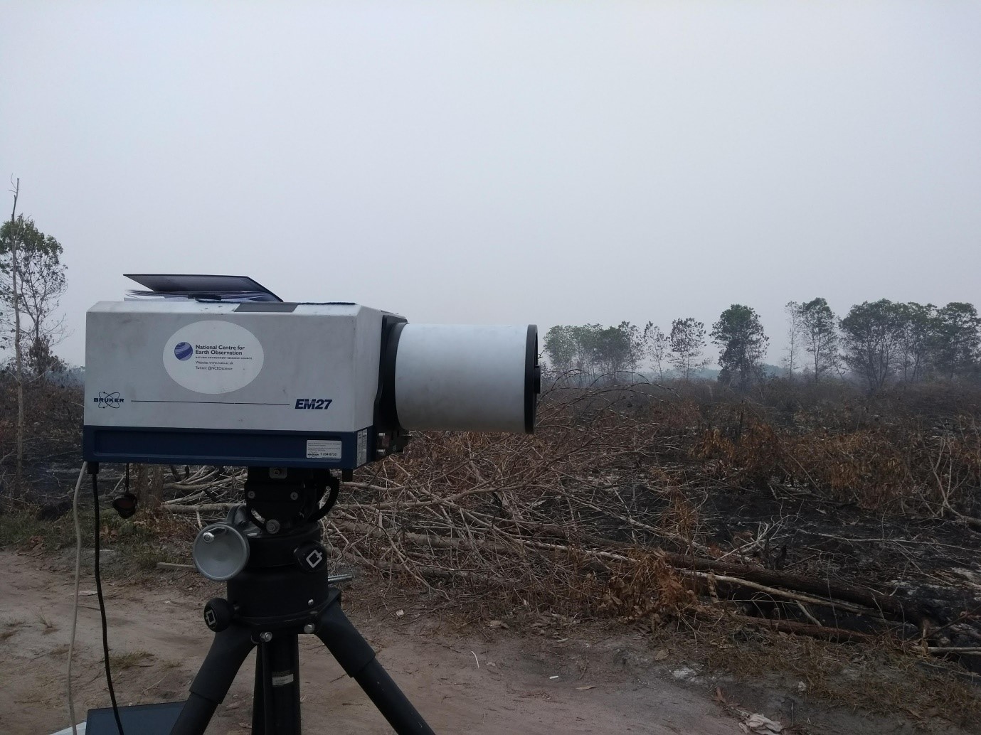
Fourier Transform Infrared Spectrometers (FTIR)
FTIR spectrometers offer the ability to detect multiple gases simultaneously and depending on concentrations, can detect dozens of gases present in smoke. Our FTIR instruments operate in several different ways including; (i) closed path gas analyser with heated sampling line and gas cell for measurement of gases at high temperatures, (ii) open path gas analyser for field measurements through a smoke plume, (iii) imaging FTIR cameras for measurement of gases in a smoke plume in a spatially resolved way.
Particulate Matter Measurements
As well as gas emissions, fires produce solid particulate matter in the smoke which can have significant impacts on the atmosphere and for human health. These are regularly reported based on size fraction for example PM2.5 (particles less than 2.5 microns in diameter). Analysers range from fixed laboratory instruments to small low cost sensors which can be deployed across wide areas such as our network in South East Asia [link].
Many particulate sensors operate by using an optical sensor to count particulates in an air stream, however, this requires an assumption on the mass of the particulates to convert this into a mass concentration, the standard way of reporting particulate matter. Our instruments include the ability to measure true mass concentrations on filter samples which can be weighed before and after exposure in our specialist weighing facility [link]. By co-locating true mass concentrations derived from filter measurements and observations from optical sensors, an adjustment factor for the optical sensors can be derived. This can significantly improve the accuracy of optical sensor.
Other Field Instruments
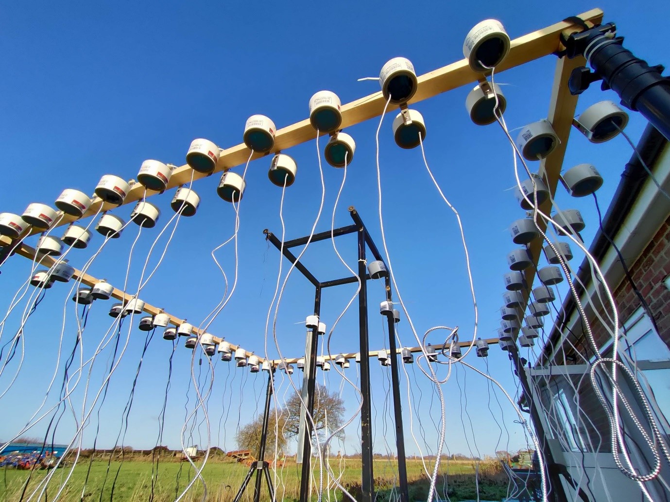
In addition to the fire specific instruments, the team also operate a range of other field instruments including portable meteorological stations, thermocouple dataloggers, and soil moisture datalogging equipment as well as a range of UAV based instruments.
Airborne Instrumentation
Many of the instruments operated by the NAEO have applications for measurements in fire environments including measurements of active fires, burn scars, smoke plumes. To achieve this, it is often necessary to collect measurements using a range of instruments working at different wavelengths to gain a fuller picture of the overall environment.
Using the British Antarctic Services’ (BAS) Twin Otter research aircraft it is possible to fly one or more instruments in the main remote sensing hatch, plus additional instruments using downward looking portholes at the rear of the aircraft. In addition to the remote sensing instruments, NAEO complement this with some in-situ gas and particulate instrumentation which can assist in validating the remote sensing datasets. For example, by flying over a smoke plume colleting thermal data, and then repeating the flight line at lower altitude through the plume to sample gases and particulate matter with the in-situ instruments.
Generally the instruments operated by the NAEO are high-specification instruments that are not suitable for use on UAVs, however, many instruments complement the UAV-based research in NCEO, but on a larger spatial scale.
Remote sensing
OWL
The Specim OWL is a commercial hyperspectral thermal imager operating in the long wave infrared (7.6-12.6µm). Using 102 spectral bands with twin black body calibration system, it is possible to derive temperature and emissivity estimates, and can also identify certain gas compounds. For more information see the NAEO website.
IBIS
The Specim IBIS is a hyperspectral thermal imager with a very narrow, but high resolution waveband (670-780nm). Whilst this is primarily designed for quantifying solar-induced fluorescence (SIF,[link]), an additional capability with fire measurements is the identification of a specific spectral feature (potassium) which is only produced from flaming fires. Together with other thermal instruments this allows classification of flaming and smouldering areas of a fire, even when the thermal signal may be partially blocked (eg from canopy vegetation in a forest environment). For more information see the NAEO website.
FENIX 1K
The Specim FENIX 1K is a hyperspectral imager operating in the visible, near-infrared and shortwave infrared region (280-2500nm). Whilst it is possible to identify hotspots with this instrument, it is primarily used for vegetation mapping of fire affected areas as it is possible to estimate vegetation health as well as overall reflected radiation from surfaces such as burned area. For more information see the NAEO website.
Thermal Cameras
The NAEO operate a range of broadband thermal cameras which are optimised for different methodologies. These include a cooled thermal imager operating in the mid-wave infrared (1.5-5.7µm), but utilising a spinning filter wheel. This allows multi-spectral data, which allows identification of certain gases (CO2) being emitted from a fire. Additionally, we use exact replicas of filters that are used on board satellites in this camera to enable validation of satellite products [link to Fidex campaign]. We also operate long wave thermal cameras, including wide field of view cameras for multi-angular measurements of fires. For more information see the NAEO website
Imaging FTIR HyperCams
TwoTelops HyperCam Imaging FTIRs systems are used by the NAEO, including a ‘long wave’ system (7.7-11.8µm) and a Methane specific system (7.4-8.3µm),
The long-wave model can quantify a broad range of species, and has been used by the NAEO to examine ammonia (NH3) emissions, a significant aerosol precursor and air pollutant. Tthe Methane system boasts a sensitivity to methane ten times higher than the long wave model, the NAEO aims to exploit this system for methane emissions from wildfires and other sources.
These systems generate images depicting the concentration of targeted gaseous species along the path length, enabling estimation of emission sources and rates. It is also possible to use both HyperCams in a ground-based tripod mounted set up. For more information see the NAEO website.
In-situ Gas, Particulate, and PAH measurements
Emissions generated from fires or combustions have complex chemical compositions, comprising gas species, polycyclic aromatic hydrocarbons (PAHs), and particulates. These emissions have adverse effects on the environment, human health, and climate change. Understanding the parameters that control their formation is crucial for effective control and monitoring.
An airborne sampling system that enables simultaneous measurements using various instruments, such as gas and particulate analysers, along with a PAH sampling filter, has been developed for the BAS Twin Otter. This setup allows for the collection and measurement of the emitted components from different sources to be used alongside our remote sensing instrumentation. This quantification offers insights into the dynamics of greenhouse gases, air pollutants, and their impacts on ecosystems and climate.
The NCEO operated MIRO MGA10 gas analyser is capable of simultaneously measuring 10 gas compounds at 1 Hz temporal resolution including: CO, N2O, H2O, CO2, NO, NO2, CH4 NH3, O3, OCS. The instrument has been integrated with the airborne sampling system adding to gas detection capabilities of the NAEO. These measurements have a range of applications including quantification of emissions from fires to accurately determine the ratios of different gases which are an important input to large scale emission inventories used in satellite-based estimates of greenhouse gas emissions, and subsequent atmospheric modelling applications.


Search datasets and tools
NCEO produces various datasets related to climate change, including measurements of greenhouse gases, atmospheric composition, land surface changes and ocean health. These datasets are valuable for understanding the dynamics of climate change on a global scale and informing policies and actions to address it.