We found 155 results for your search.
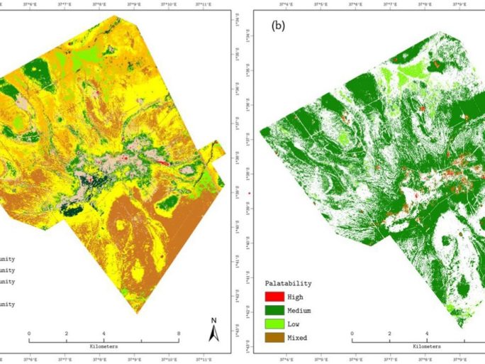
…and soil types may require more validation. Figure 2. Vegetation composition and forage palatability at Kapiti Research Station derived from optimized endmember MESMA. (a) Dominant land-cover and plant communities: Bare ground (brown), Cynodon spp. community (red), Kunthii spp….
…the wider public. Our Values and Social Responsibility We are committed to promoting responsible research and innovation practices in step with Natural Environment Research Council (NERC) and its parent body…
…fires or combustions have complex chemical compositions, comprising gas species, polycyclic aromatic hydrocarbons (PAHs), and particulates. These emissions have adverse effects on the environment, human health, and climate change. Understanding…
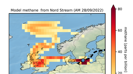
…than carbon dioxide over short timescales, contributing significantly to climate change. However, previous estimates of the total methane released from the pipelines varied widely due to differences in how the…
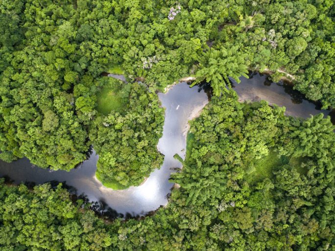
…better understand the linkages between the water and vegetation productivity from plot to continental scales so as to better understand how these processes should be represented in climate models. In…
…of UKRI institutes, public sector establishments and commercial organisations who are known for their expert capabilities in EO data, computing and data quality systems. Our new partners are: Airbus Defence…
…technologies that are needed to get us on a path to net zero. Our team comprises not only environmental and computer scientists but also social scientists, behavioural scientists and media…
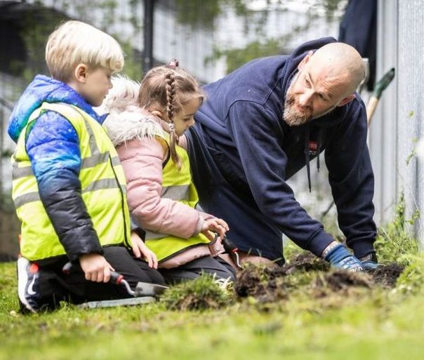
…celebration. Our event served as inspiration for raising awareness about environmental conservation and engaging participants from the local community in a series of eco-friendly activities. Year one students from Wolsey…
…cutting-edge techniques needed to unravel the complexities of Earth’s climate system.” Over its mission lifetime of three years, EarthCARE will advance our understanding of cloud properties and processes, paving the…
…scales. We are combining these observations with state-of-the-art models to improve our understanding of processes, reduce uncertainty in predictions of the future and provide information to help inform decision-making. Understanding…
…explaining the valuable information from satellites. NCEO welcomes statement to COP on behalf of Earth Observation community delivered by the UK As Chair of the Committee on Earth Observation Satellites…
…and regional carbon cycles due to the high resolution of the data it generates. Our analyses can support countries to understand how their forests connect to their international climate commitments…
…digital archive of ancient oak trees that’s openly accessible for the public. 2. Compare and contrast the architecture of ancient oak trees with different histories (for example, trees with different…
…communities across the UK, enabling them to harness the benefits of satellite data and space technology The National Centre for Earth Observation has joined the consortium which will link diverse communities…
…glacier This brief activity uses false-colour images of the Columbia glacier in Alaska to introduce the idea of using sequences of satellite images to monitor change. It focuses on the…
…these quantities would change as they moved a camera to a series of vantage points above the surface of the Earth. There is an optional practical component. Pack includes: worksheet…
…air pollution. Research priorities Multiscale biosphere-atmospheric interactions, particularly at urban-rural boundaries. Understanding observed changes in atmospheric methane. Developing robust and transparent data products and uncertainties. Disseminate this knowledge to…
…researchers seeking to understand the Copernicus data landscape. Image: @NASA The Landsat Series Led jointly by USGS and NASA, the Landsat Programme comprises a series of Earth observation satellite missions,…
…wider science, policy and business communities. It draws on decades of world-leading UK expertise and international collaboration to address the most urgent challenges (e.g., societal climate impacts) by understanding changes…
…UKNCSP, and together I believe we can build on the good progress already made under our initial activities around making the full use of climate observations, coordinating new global climate…
…ground and from the sky This activity introduces remote sensing by asking pupils to match and compare photographs of features such as lakes, mountains and cities taken from the ground…
Home News and Media Photo Credit @ESA – Biomass takes to the skies NCEO led Mission to Map the Worlds Forest Launches Developed by British academic and engineers, BIOMASS is…
…estimates of carbon stored in wood across the Amazon and how it changes over time. In combination with model-data fusion approaches, this could be instrumental in understanding the overall Amazon…
Data Services Home Data Services Understanding global environmental issues requires robust computational resources, as well as efficient data access, storage and archiving systems. Within the NCEO, the Centre for Environmental…
…increases. As we try to achieve Net Zero targets and meet commitments to the Methane Pledge to reduce methane emissions, it is vital that we understand the background of underlying…