Finding Satellite Image
Earth observation images in the classroom
Well-chosen satellite images are a great way to stimulate discussion in the classroom – and beyond. Thanks to weather forecasts and mapping apps, many of us can identify land, sea, cloud, major features and maybe even countries from a satellite image. But look carefully at a good-quality image and you will find interesting questions to ask.
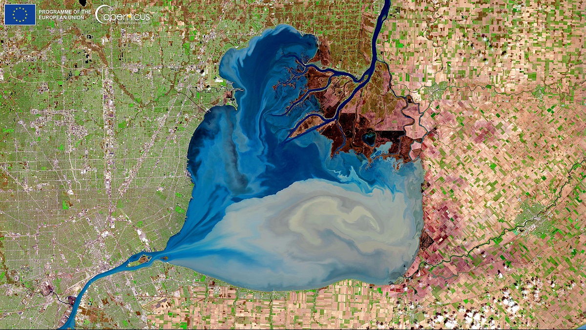
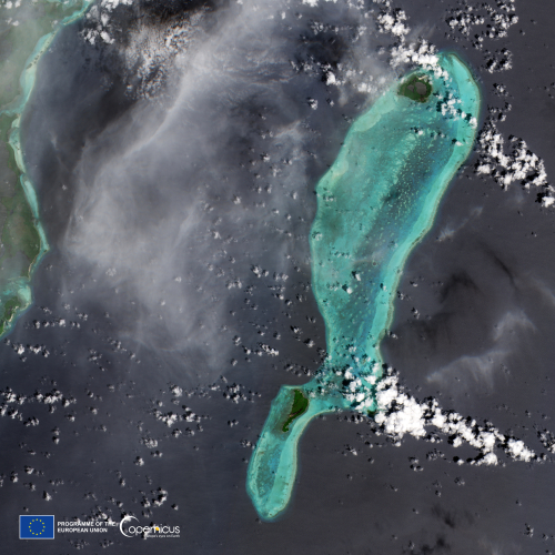
For example, in this image:
- What might the blue shape be?
- What things can you see that might have been made by people?
- Why might the rectangles have different colours?
- What time of year might this be?
- What might cause the swirling patterns?
- How might we use images like this?
- Are there any clues in the picture to help us work out the country?
This means you can use satellite images as prompts when teaching almost anything: not just geography but also history, art, citizenship, English … You might also use them to answer or explore specific questions – see Astronaut photography for ideas – or to support the teaching of particular concepts in maths, science, geography or computing, as in our EO Detective resources.
Ready-made images
Many Earth observation programmes curate collections of spectacular or/and newsworthy satellite images that you can download to use in your classroom. Try:
All of these websites have search functions to help you look for particular features (volcanoes, lakes, forests …). They also provide information about each of the images they feature so you have some support in pointing your students towards key parts of the picture and – hopefully – answering the questions they come up with. Best of all, since these organisations are taxpayer-funded, the images are all free to use.

Finding images of a particular place
What happens if you want a satellite image of a particular place that has not appeared in any of these collections? Never fear, there are many sites that you can use to access EO data from the major public programmes.
While some of these provide raw data for EO scientists, there are others that allow you to produce images you can download and use.
One of these, EO Browser, gives you access to data from several families of satellites to create images with a resolution (in visible wavelengths) of 10–30 m per pixel. Although these are not detailed enough to pick out individual houses or vehicles, you will be able to identify natural and human features in the images you create.
What to do
All you need to use a site such as EO Browser is a computer connected to the internet. There is an introductory tutorial but, if you prefer to have a printed guide, you could download our instructions.
You might also want to use your favourite image-processing software to tweak the image you have downloaded but you can get good results without it.
Going further
You can also use EO Browser to produce images like some of the more weird and wonderful ones that appear on the websites above: the sort where plants are red, or snow is blue. To find out more about these possibilities, explore the links below, which are arranged in order of ease of use (there is some repetition).

EducationResources
Earth observation data, images and contexts are a great way of delivering parts of the core curriculum in a new way.
You do not have to prepare lessons using them for yourself: there are a growing number of ready-to-use resources available that contain everything you need to give it a go.
