News and Media
Water Cycle

What is the water cycle?

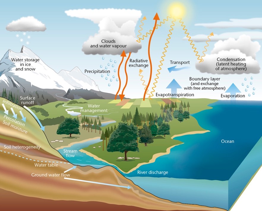
The water cycle is the movement of water from the ocean to the atmosphere, then to the land, and back to the ocean. It is powered by solar energy. As sunlight reaches the Earth, it heats the atmosphere, land, and ocean, causing water to evaporate. The water vapour condenses onto tiny particles in the atmosphere called aerosols to form the droplets and ice particles that constitute clouds. Collisions of cloud droplets, and continued condensation, result in the growth of larger rain drops and snowflakes that eventually fall to the ground as precipitation.
These processes are illustrated in the figure below:

Monitoring changes in the water cycle is important for understanding how the Earth system responds to human activity. Increased greenhouse gas emissions over the last century affected the water cycle, as warmer air can hold more water vapour. Greater availability of water vapour intensifies the water cycle, resulting in more pronounced weather events such as floods, hail, and droughts.
Traditionally, precipitation measurements have been performed using precipitation gauges. These instruments vary in design, performance, and accuracy but share the common purpose of directly measuring the amount of water that falls into a particular catchment over a specified period. Despite their value, these measurements are sparsely distributed globally. In fact, the total area covered by rain gauges globally is equivalent to half of a football pitch.
Today, measurements from rain gauges are complemented by networks of weather radars on the ground or various instruments on satellites. These measurements offer the advantage of improved spatial coverage, but they do not directly measure precipitation. Radars gauge the energy reflected by precipitation, while infrared cameras on satellites provide information on the temperature of the cloud tops, and so on.
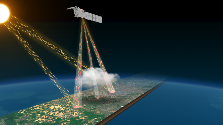
NCEO researchers play a vital role in transforming these quantities into meaningful values. We develop cloud and precipitation algorithms for currently operating (e.g. GPM) and upcoming (e.g. EarthCARE) satellite missions. The NCEO team at the University of Reading produces cloud, aerosol, and precipitation retrievals utilizing data from multiple instruments aboard the EarthCARE satellite.
Additionally, the NCEO team at the University of Leicester delivers a cloud and precipitation product specifically based on the EarthCARE radar. NCEO also designs new measurement concepts (GRaCE) that further advance our understanding of weather systems. We concentrate on generating reliable datasets to guarantee the trustworthiness of the conclusions derived from them. In this way we contribute to better understanding the processes governing the water cycle, and to the improvement of weather and climate models.
Tools
- Global Precipitation Measurement (GPM) mission satellite (GPM Dual-frequency Precipitation Radar, GPM Microwave radiometer)
- ESA’s EarthCARE (Cloud, Aerosol and Radiation Explorer) mission
- G-band Radar for Cloud Evaluation (GRaCE)
Contact
For further information contact Dr. Adam Povey (adam.povey@le.ac.uk) and Dr. Kamil Mroz (kamil.mroz@le.ac.uk)
Latest News and Events


