News and Media
Canadian Wildfires Campaign
Large-scale campaigns took place in Ontario, Canada in 2018 and 2023 to investigate emissions from wildfires observed from the air and ground.
These campaigns were part of a European Space Agency funded project (FIDEX & FIDEX 2) alongside a collaboration between the King’s NCEO team and the Canadian Forest Service and Ontario Ministry for Natural Resources.

Airborne studies of fires in Canada
In 2018, ESA provided funding for our group at King’s to conduct an airborne study of fires in Canada. The main aim of this campaign was to fly over active wildfires at exactly the same moment that a Sentinel-3 satellite passed overhead. The thermal map of the fire recorded from instruments onboard the plane could then be directly compared to the exact same measurements recorded from space.
There were 10 successful flights where the team managed to measure the fires during Sentinel-3 overpasses. The data of which was used to check the accuracy of the satellite products that King’s have developed.
ESA provided King’s with further funding to repeat the campaign, in order to increase the quantity and range in size of the fires in this airborne-spaceborne matchup dataset. The campaign was originally planned for 2020 but was pushed back to 2023 due to the Covid pandemic. Therefore, the team at King’s ended up conducting an airborne campaign over fires in Canada during its most intense fire season on record. The 2023 campaign expanded further to include a complementary ground campaign which saw researchers from KCL and CFS alongside a fire ranger crew collect measurements from a fire front.
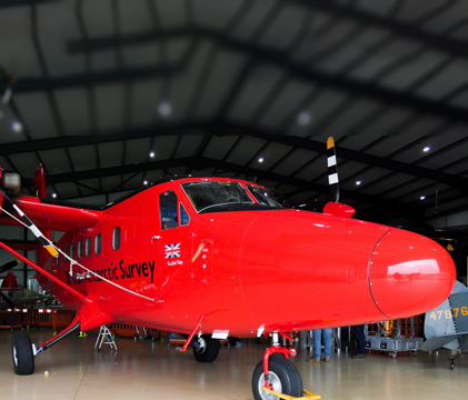
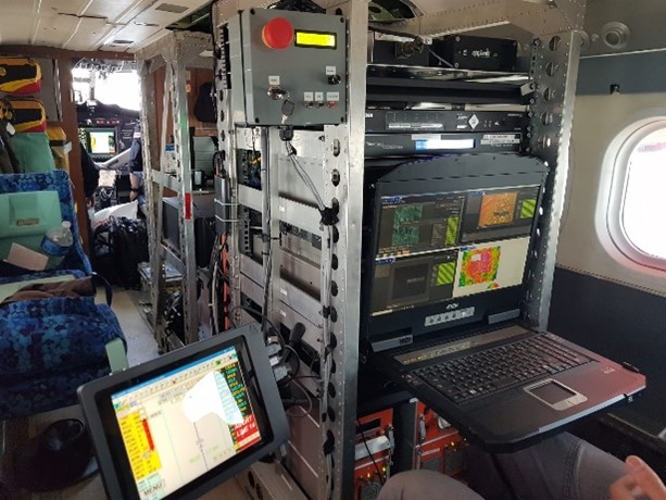
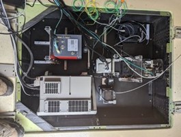
The campaigns saw the NCEO-King’s team fit out a British Antarctic Survey Twin Otter aircraft with a range of thermal and hyperspectral instruments — in 2023 there were a total of 17 instruments fitted at the same time. Prior to the campaign the NCEO-King’s team designed, built, and tested instrument mounts. The team then also fit instruments and associated computing into the aircraft before test flights and boresights can begin.
Campaign objectives
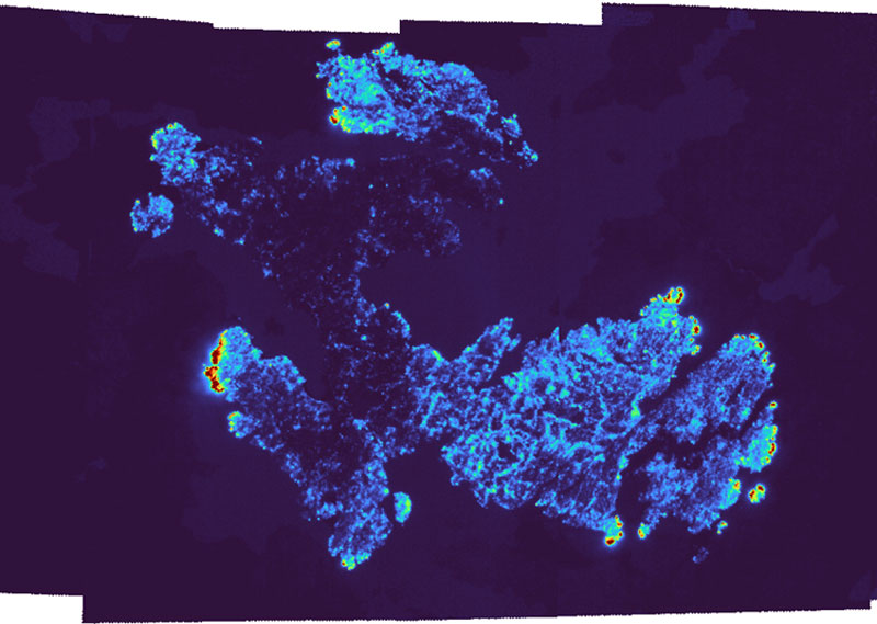
Whilst there were several objectives of the campaign one key objective was to fly over a fire at the same time as a satellite overpass (ESA Sentinel 3) in order to gain higher resolution data to validate the algorithms used on the satellite dataset for fire radiative power estimates, which the NCEO-King’s group developed as part of a separate project.
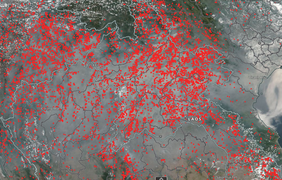
Target fires would be identified from active fire products to identify fires within a suitable range of the aircraft, that were not being supressed or managed, and that were likely to still be active at the next Sentinel-3 overpass. Additionally, weather needed to be closely monitored as cloud free conditions were required to ensure both the plane and satellite would see the fire. Once all these factors were accounted for, a set of flight plans could be created to map the target fire.
Geo-correction and validation
After the data collection, the data must be geo-corrected to ensure the imagery matches the correct locations which for some instruments is carried out by NEODAAS and other instruments by the NCEO-King’s team.
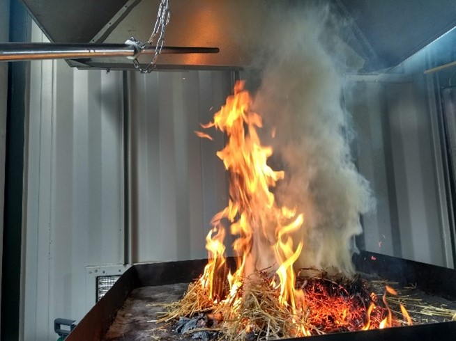
Quantifying the gas and particulate emissions from an active fire
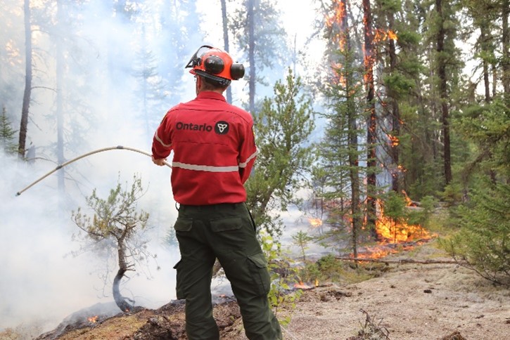
In addition to the air campaign, a simultaneous ground campaign took place. This saw a group of scientists from the NCEO-King’s team alongside scientists from the Canadian Forest Service deployed to an active fire front with a fire ranger crew. There were several objectives including quantifying the gas and particulate emissions from fires to link up with the airborne and satellite remote sensing aspects of the campaign, as well as determining fuel characteristics, and fire ranger crew exposure to particulates hazardous to health. The target fire had already been burning for months and a base camp and staging area used during the earlier phase of the fire was utilised for the science base and camp area for the science and ranger teams. From here the Ontario Ministry of Natural Resources were able to fly the fire crew, scientists, and equipment in and out of the fire on several days. A close eye had to be kept on changing smoke conditions as on some days it was necessary to make a quick exit before the visibility became too poor for flying. On other days, smoke was so bad it was not possible to fly in to the site.
Due to the dynamic nature of an active fire front, the science team needed to adapt the science plan regularly to changing conditions and to fit with logistical limitations. Emissions data collected from the ground, and from helicopter will be analysed alongside higher altitude measurements from the Twin Otter to help characterise fire emissions from this region.
Contact
For further information contact Professor Martin Wooster.
Share this article


Published by Fazila Patel
Digital Communications Officer
University of Leicester