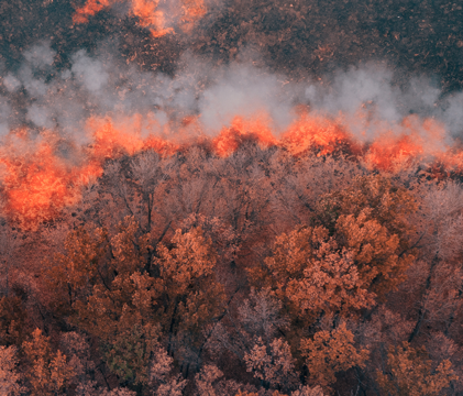
Wildfire Research Key Datasets
NCEO have developed of a series of data products focused on the location and time of landscape fires.
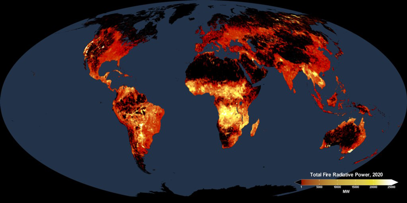
Over the years, we have developed of a series of operational products based on satellite data feeds – most focused on the location and time of landscape fires, their Fire Radiative Power (FRP, in MWatts) – and the rate at which fuel (vegetation and/or organic soil) is being consumed and that smoke is being released.
Measuring FRP from space provides a way to estimate rates of release of smoke to the atmosphere from the scale of individual fires to the whole globe. Integrating FRP over a a particulate time gives the total Fire Radiative Energy (FRE), which for wildfires should be approximately proportional to the total mass of fuel consumed and the total amount of any gaseous or particulate compound released.
Geostationary FRP products
NCEO has developed a series of global fire detection and FRP characterization systems, and the system based on Meteosat Second Generation has been used operationally to provide information on landscape fires burning across Europe and Africa for more than a decade, attracting thousands of users from government agencies, scientific organizations, and decision-makers such as those involved in fire response and air quality forecasting.
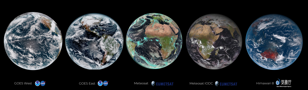
The Meteosat FRP product is generated every 15 mins at the EUMETSAT Land Surface Analysis Satellite Application Facility. There is also a matching Meteosat India Ocean Data Coverage FRP-Pixel Product generated from the Meteosat positioned over the Indian Ocean. Further geostationary FRP products are produced from the GOES-R systems (now operating as GOES-E and GOES-W over the America’s) and from Himawari over Asia. These data are available in near real time at the full resolution of the instruments (every 10 minutes for GOES-R and Himawari).
NCEO is currently developing a state-of-the-art FRP system based on the Meteosat Third Generation (MTG) satellite. The MTG represents a significant advancement in geostationary meteorological satellite observations, offering innovative features that enhance weather forecasting, climate monitoring, and environmental monitoring capabilities. Particularly relevant for wildfire applications is the fact that MTG images the UK every 10 minutes (and in the future every 2.5 minutes) in multiple spectral bands, including those highly sensitive to hot targets, with spatial resolution approximately 10 times higher than the previous Meteosat Second Generation.
Sentinel-3 FRP product
The Sentinel-3 mission is jointly operated by ESA and EUMETSAT to deliver operational ocean and land observation services, including information on landscape fires. Two Sentinel-3 satellites provide daily global data from near-polar, sun-synchronous orbits with a descending (ascending) node equatorial crossing at 10:00 hrs (22:00 hrs) Mean Local Solar time. Data from Sentinel-3’s Sea and Land Surface Temperature Radiometer (SLSTR) are used to generate a Level 2 Active Fire Detection and FRP product, based on the algorithm developed pre-launch by NECO Scientists Wooster et al. (2012) and updated and optimised post launch by Xu et al. (2020).
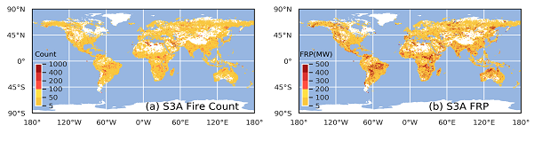
Total active fire (AF) pixel count and total FRP of fires detected within 0.25° grid cells from March 2022 to February 2023 using all Sentinel-3A
Global Fire Assimilation System
We also worked on developing parts of the Global Fire Assimilation System (GFAS), currently operated as part of the Copernicus Atmosphere Monitoring Service (CAMS) and so with a user base of hundreds or perhaps thousands of people per day worldwide who use its air quality and greenhouse gas information. Once the FRP observations are available within GFAS, they are converted to landscape fire emission estimates, covering more than 40 different compounds (e.g. carbon, CO2, CO, black carbon aerosol, organic carbon aerosol, total particulate matter, etc). Our fire emission research also supports the UK Earth Observation Climate Information Service in generating fire emissions from geostationary satellites
Active Fire Detection Validation
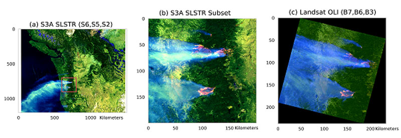
Validation of active fire detection in a scientific way is vital to ensure the accuracy and reliability of the fire detection algorithms. Landsat, MODIS and VIIRS data provides higher resolution imagery that allows for the more precise identification and mapping of active fires than geostationary satellites. By comparing the fire detections from the algorithms with the known fire locations observed in the higher resolution imagery such as Landsat, scientists can evaluate the performance and effectiveness of the fire detection methods. This validation process helps to improve the accuracy of fire detection systems and enhance their usefulness in monitoring and managing wildfires.
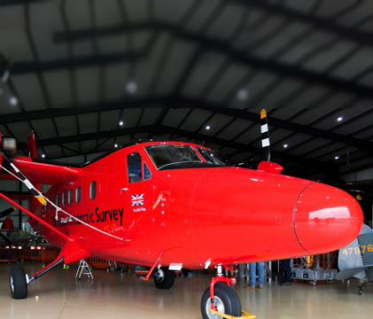
Airborne Earth Observation
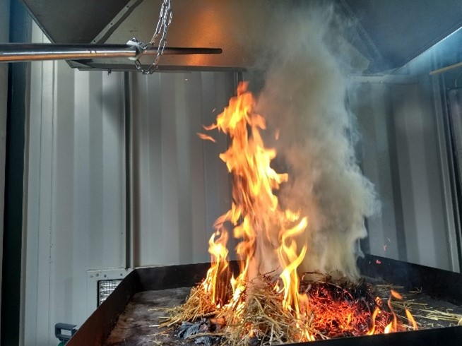
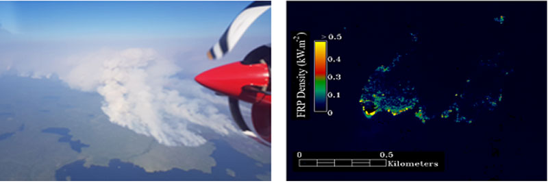
Several airborne campaigns were planned and conducted in support of the Sentinel-3 fire product development and validation. The main activity was to collect airborne data of actively burning fires at the same time as the Sentinel-3 satellite passed overhead, so the results from the satellite based active fire product could be compared to the much more spatially detailed airborne data. To achieve this, aircraft were fitted with a series of thermal imaging devices, primarily a middle infrared camera equipped with a spectral filter matching that of the SLSTR sensors’ middle infrared band. [link to Canada campaign page]
Fire Radiative Energy Emissions
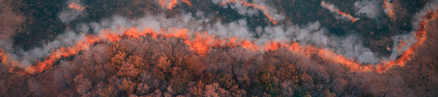
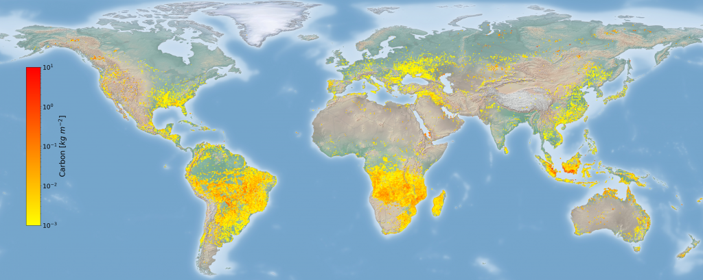
Landscape wildfires can be ignited via natural or anthropogenic sources, both accidentally or purposefully; such as for vegetation clearing or fuel-load management. Wildfires can affect a large range of biome types; such as boreal, temperate, and tropical forests, grasslands, shrublands, and peatlands, and are capable of emitting vast quantities gaseous and particulate matter into the atmosphere. The Copernicus Atmosphere Monitoring Service (CAMS) estimates that global wildfire activity generated approximately 2170 megatonnes (2,170,000,000,000kg!) of carbon into the atmosphere in 2023, with the Canadian wildfires throughout May – October accounting for 22%.
These estimations are often made from estimations of EO burnt area and EO Fire Radiative Power (FRP), however they are subject to uncertainties surrounding burnt completion and fuel consumption per unit area, resulting in large uncertainties and biases. Work done by the NCEO team at Kings College London is looking at alternative methods for estimating emissions from wildfires; by directly linking EO FRP observations to EO observations of Carbon Monoxide via the Tropomi instrument onboard Sentinel-5P.
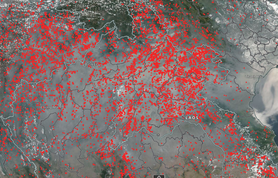
By identifying cloud-free smoke plumes in satellite observations, it is possible to develop a relationship between the Carbon Monoxide estimates within the smoke plume with FRP observations for fires of different biomes, thus developing biome-specific emission coefficients. These biome-specific emission coefficients can be used to better estimate the emissions of Carbon Monoxide from wildfires globally. This method has been found to work with fires across Africa (using FRP observations from the SEVERI instrument onboard the geostationary Meteosat Second Generation satellite), and is currently being developed for fires across Europe and for boreal regions (using the VIIRS instrument onboard the polar-orbiter Suomi NPP and Joint Polar Satellite System Satellites, shown below).