Open Access Courses
Knowledge Hub

We offer a diverse range of specialised training programs throughout the academic year to help you build your knowledge in EO application, including remote sensing, data assimilation, and machine learning/artificial intelligence.
These programs are open to researchers from all backgrounds, offering opportunities for skill development and knowledge enhancement. Whether you’re a novice or an expert, our courses are designed to accommodate diverse skill levels. Additionally, we provide bespoke programs tailored to specific needs. For further information or to inquire about our training opportunities, please feel free to reach out to us.

In-person Courses
Remote Sensing
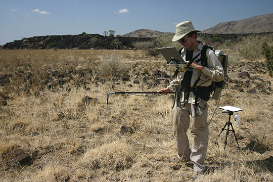
Our Remote Sensing course is beneficial for ecologists, volcanologists, marine biologists, and others. It is conducted annually and in-person by our specialists from NERC’s Field Spectroscopy Facility (FSF) and NEODAAS .
Through this hands-on field course, participants have the opportunity to delve into the intricacies of remote sensing equipment available for hire from FSF, gaining insights into its diverse applications and uses across various disciplines. For further details and enrolment, please contact FSF directly.

Data Assimilation
Our Data Assimilation training, widely favoured by weather predicting agencies worldwide, is offered as a four-day program available both in-person and online.
Hosted at Reading University in collaboration with the Data Assimilation Research Centre (DARC), this comprehensive course provides participants with invaluable insights into the principles and practices of data assimilation. To learn more about this training opportunity, please visit the Training section on the DARC website.

Machine Learning and Artificial Intelligence for EO
NEODAAS offers an annual machine learning and artificial intelligence training program tailored specifically for Earth observation scientists.
This comprehensive training initiative covers a diverse range of topics and is designed to enhance participants’ skills in leveraging machine learning and artificial intelligence techniques for Earth observation applications. To explore the full spectrum of upcoming training events and to learn about past bespoke training sessions, please visit the Support and Training section on the NEODAAS website.
Introductory Training
Online Courses
Fundamentals of Remote Sensing
The NASA Earth Science Applied Science course on Fundamentals of Remote Sensing is an invaluable resource for individuals new to Earth observation (EO).
This course offers a comprehensive overview of remote sensing, covering essential concepts such as spatial and spectral resolution, as well as data processing levels.
EO Data Landscape
This talk provides valuable insights into satellite data landscape, focusing on marine and optical terrestrial data.
This presentation is useful for anyone interested in utilising satellite data for environmental monitoring, research, or decision-making processes.

Data Assimilation
DARC offers a comprehensive introduction to data assimilation through their Massive Open Online Course (MOOC).
In this course, participants can delve into the fundamentals of data assimilation, gaining insights into its applications, methodologies, and practical implementation.
Research Data Management
As a partner in Data Tree, NCEO offers a free online course covering essential aspects of research data management, including strategies for engagement and data sharing with stakeholders such as businesses, policymakers, media, and the general public.
Tailored for scientists at all career stages, the course is particularly beneficial for PhD students and early career researchers but welcomes anyone seeking to cultivate effective data management practices. The course can be accessed here.

JASMIN Training
Centre for Environmental Data Analytics (CEDA) is one of our primary data hubs, housing the vast volumes of Earth observation (EO) data that our researchers work with.
If you find yourself working with EO data, it’s highly likely that you’ll need access to JASMIN, the high-performance supercomputer hosted by CEDA.
Satellite Data sources
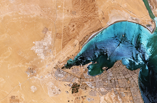
As a Copernicus Academy and Relay, NCEO is committed to educating and informing individuals about Copernicus data and its utilisation. Copernicus, the European Union’s Earth Observation Programme, offers a range of information services based on satellite EO and in-situ data. Coordinated by the European Commission and implemented in partnership with organisations like the European Space Agency (ESA) and EUMETSAT, Copernicus is supported by dedicated satellite missions known as Sentinels. These missions, developed by ESA, provide valuable data for various applications, and the Sentinel website offers comprehensive information on each mission’s capabilities.
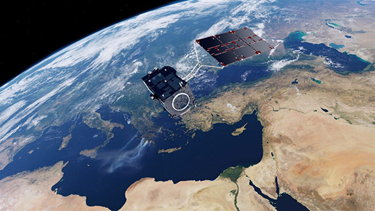
Sentinel 1, 2 & 3: Technical Capabilities
This video provides an overview of the technical capabilities of the Sentinel satellites, highlighting their significance in Earth observation. sentinels.
The Copernicus Marine Landscape discussion
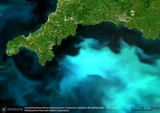
In this informative video, Hayley Evers-King from EUMETSAT discusses the Copernicus Marine Landscape, offering insights into different missions, mechanisms, and agencies involved. While marine-focused, this discussion is beneficial for researchers seeking to understand the Copernicus data landscape.
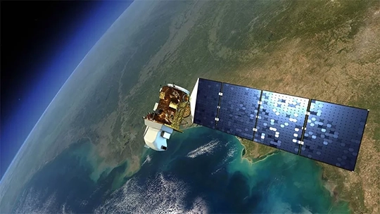
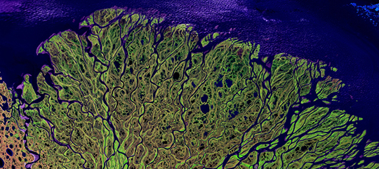
Image: @NASA
The Landsat Series
Led jointly by USGS and NASA, the Landsat Programme comprises a series of Earth observation satellite missions, including Landsat 1 to Landsat 9. Known for their moderate-resolution optical remote sensing capabilities, Landsat satellites have been continuously observing the Earth for over four decades.
The video – “Continuing Landsat’s 40-year Legacy ” delves into the Landsat series, with a focus on Landsat 8 and the recent launch of Landsat 9, which now allows for observations every 8 days using both satellites.
Introduction to Machine Learning for Remote Sensing Data
NEODAAS, the second data hub under NCEO’s purview, operates as the NERC’s Earth Observation Data Acquisition and Analysis Services, located at the Plymouth Marine Laboratory (PML).
Introduction to NEODAAS AI Services
This video comprehensively outlines NEODAAS’s service offerings, ranging from ocean near real-time data to their specialized machine learning expertise.
When Deep Learning meets satellite imagery
This video explores critical considerations when integrating satellite imagery into machine learning and artificial intelligence applications.
Machine Learning for Remote Sensing Data Analysis
This video delves into advanced techniques for analysing remote sensing data, comparing traditional error estimation methods with the use of biophysical parameters and hyperspectral sensors for enhanced accuracy.
Technical Courses

Monitoring croplands using data assimilation (DA) techniques
The Python notebooks included in this repository were developed for a training workshop that aimed to introduce a heterogeneous community of weather scientists, meteorologists, remote sensing experts, agronomists, etc. to current developments in using Earth Observation (EO) data for crop monitoring. To this end, several Python codes and self-directed Python notebooks were developed.

An Introduction to librat: a Monte Carlo ray tracing radiative transfer model
Librat is a flexible, modular radiative transfer model designed to simulate the light environment (reflectance, lidar return) of structurally and spectrally realistic 3D scenes. Specifically designed for simulating remote sensing instruments and observations, at arbitrary scales from cm to km it has many features specific to these aims, including a wide range of options for dealing with sensor and illumination characteristics etc., including for time-resolved lidar signals.
Internal Staff Courses
Staff Training Programme help our staff with the knowledge, skills, and perspectives necessary to excel in their roles and make meaningful contributions to our shared mission.
During the training, participants will engage with online, self-paced induction modules designed to provide a thorough understanding of NCEO’s mission, methodologies, and the significance of Earth observation data.